Reilly, Franz Johann Joseph von (1766?1820)Antiquariat.de

5 783 résultats
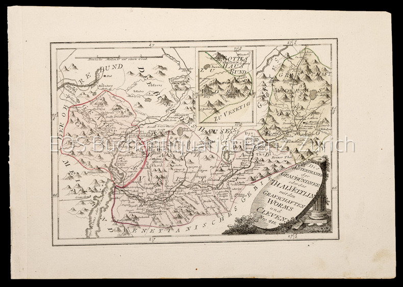
17891028CGWien, Reilly, 1789?1806. Kupferstich Nr. 415. ? Die Unterthanen der Graubündner oder das Thal Veltlin mit den Grafschaften Worms und Cleven. Blattgrösse: 29,5 x 41,5 cm. Plattengrösse: 23,5 x 32,5 cm. + Wichtig: Für unsere Kunden in der EU erfolgt der Versand alle 14 Tage verzollt ab Deutschland / Postbank-Konto in Deutschland vorhanden +, A
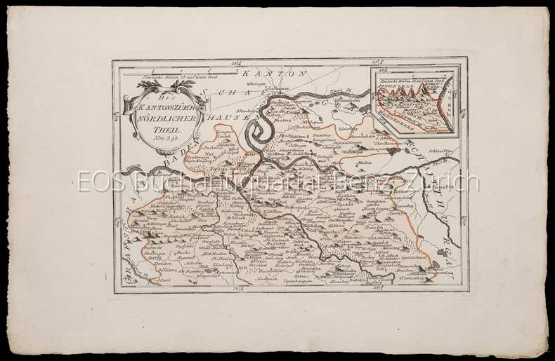
17891033CGWien, Reilly, 1789?1806. Kupferstich Nr. 391 ? Der Kanton Zürich nördlicher Theil. Blattgrösse: 31 x 48,5 cm. Plattengrösse: 22,3 x 33,5 cm. + Wichtig: Für unsere Kunden in der EU erfolgt der Versand alle 14 Tage verzollt ab Deutschland / Postbank-Konto in Deutschland vorhanden +, A
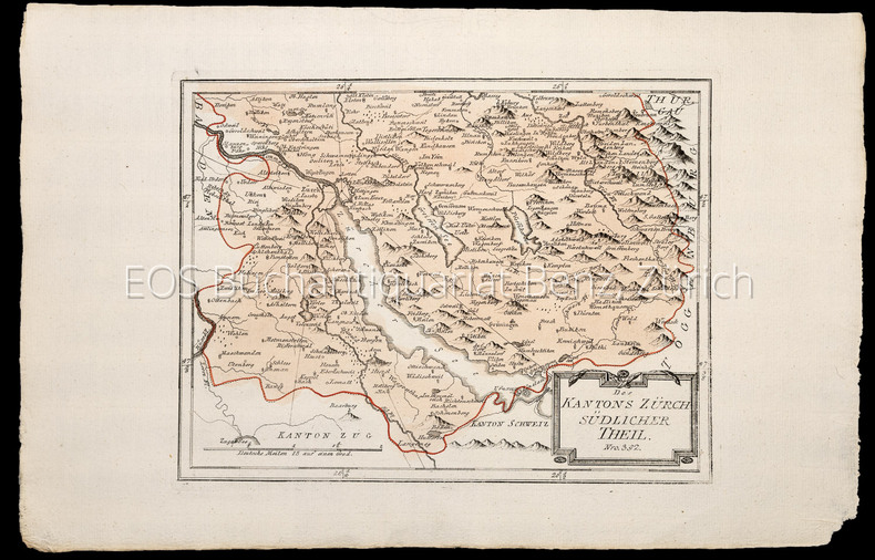
17891027CGWien, Reilly, 1789?1806. Kupferstich Nr. 392. ? Des Kantons Zür(i)ch südlicher Theil. Blattgrösse: 31 x 48 cm. Plattengrösse: 24,5 x 31,5 cm. + Wichtig: Für unsere Kunden in der EU erfolgt der Versand alle 14 Tage verzollt ab Deutschland / Postbank-Konto in Deutschland vorhanden +, A
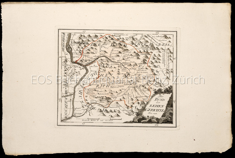
17891034CGWien, Reilly, 1789?1806. Kupferstich Nr. 414. ? Der Bund der zehn Gerichte (Teil Kanton Graubünden). Blattgrösse: 32 x 48 cm. Plattengrösse: 21,5 x 26,5 cm. + Wichtig: Für unsere Kunden in der EU erfolgt der Versand alle 14 Tage verzollt ab Deutschland / Postbank-Konto in Deutschland vorhanden +, A
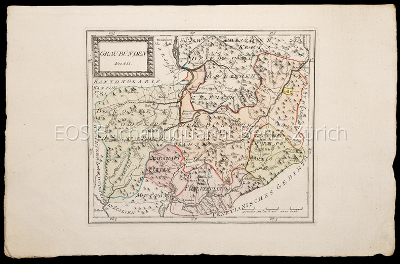
17891032CGWien, Reilly, 1789?1806. Kupferstich Nr. 411. ? Graubünden. Blattgrösse: 31,8 x 48 cm. Plattengrösse: 25 x 29,5 cm. + Wichtig: Für unsere Kunden in der EU erfolgt der Versand alle 14 Tage verzollt ab Deutschland / Postbank-Konto in Deutschland vorhanden +, A
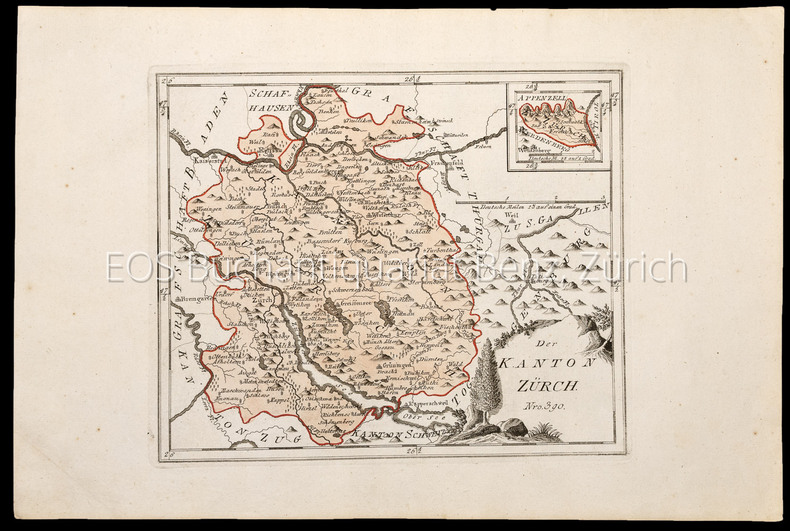
17891026CGWien, Reilly, 1789?1806. Kupferstich Nr. 390 ? Der Kanton Zürich. Blattgrösse: 30,4 x 45 cm. Plattengrösse: 23,5 x 28,8 cm. + Wichtig: Für unsere Kunden in der EU erfolgt der Versand alle 14 Tage verzollt ab Deutschland / Postbank-Konto in Deutschland vorhanden +, A
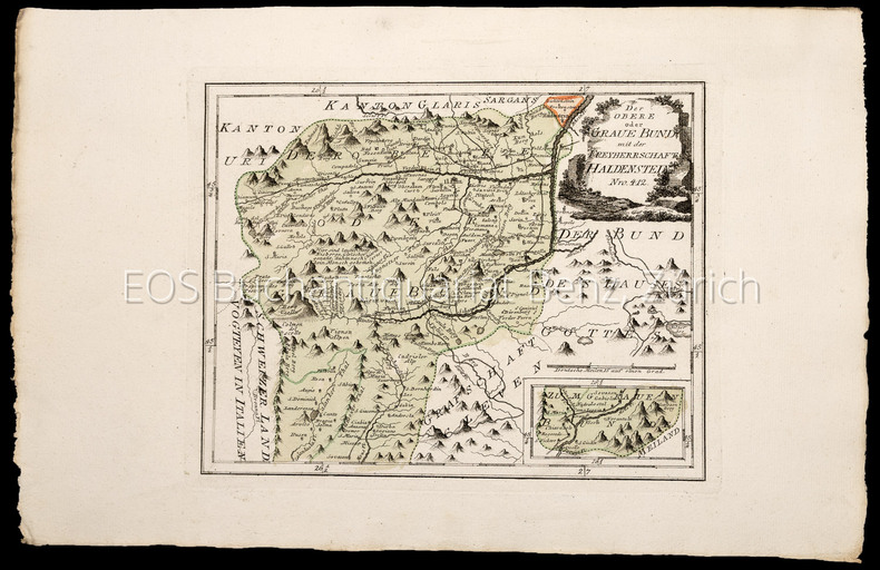
17891030CGWien, Reilly, 1789?1806. Kupferstich Nr. 412. ? Der obere braue Bund mit der Freyherrschaft Haldenstein (Teil Kanton Graubünden). Blattgrösse: 31,5 x 48 cm. Plattengrösse: 24,5 x 30,8 cm. + Wichtig: Für unsere Kunden in der EU erfolgt der Versand alle 14 Tage verzollt ab Deutschland / Postbank-Konto in Deutschland vorhanden +, A
74723aafMeilen, Verein für wirtschaftshistorische Studien, 1990, gr. in-8°, 95 S., illustriert, broschiert.
116424aaf1842-1862, 55 x 75 cm la carte, 22 feuilles (sur 25) + 2 doubles, légères rousseurs, quelques fentes aux plis, ms. Ernest Dapples ing. sur la toile au verso, montées sur toile.
17891026CGWien, Reilly, 1789–1806. Kupferstich Nr. 390 – Der Kanton Zürich. Blattgrösse: 30,4 x 45 cm. Plattengrösse: 23,5 x 28,8 cm.
17891033CGWien, Reilly, 1789–1806. Kupferstich Nr. 391 – Der Kanton Zürich nördlicher Theil. Blattgrösse: 31 x 48,5 cm. Plattengrösse: 22,3 x 33,5 cm.
17891027CGWien, Reilly, 1789–1806. Kupferstich Nr. 392. – Des Kantons Zür(i)ch südlicher Theil. Blattgrösse: 31 x 48 cm. Plattengrösse: 24,5 x 31,5 cm.
17891032CGWien, Reilly, 1789–1806. Kupferstich Nr. 411. – Graubünden. Blattgrösse: 31,8 x 48 cm. Plattengrösse: 25 x 29,5 cm.
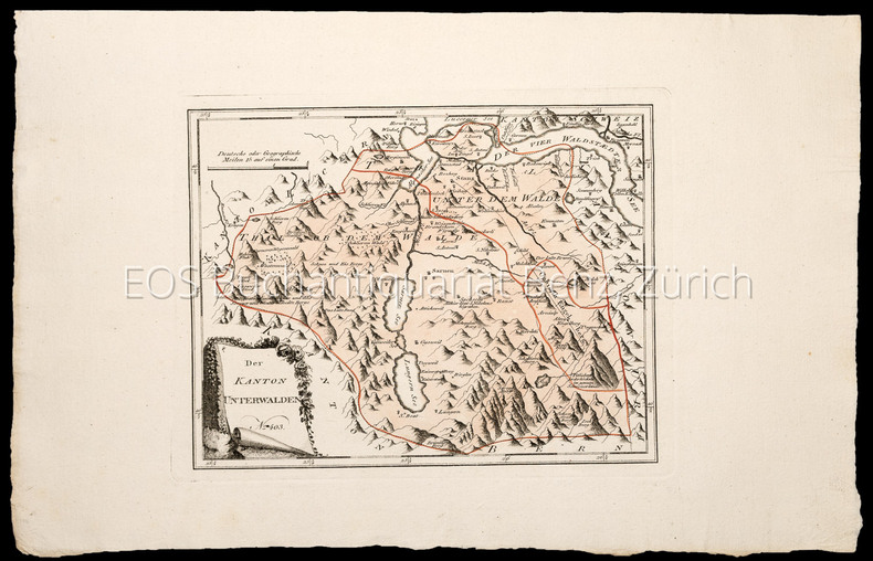
17891029CGWien, Reilly, 1789–1806. Kupferstich Nr. 403. – Der Kanton Unterwalden. Blattgrösse: 30,5 x 47,7 cm. Plattengrösse: 22 x 28,5 cm.
17891031CGWien, Reilly, 1789–1806. Kupferstich Nr. 413. – Der Bund des Hauses Gottes. Worms (Veltlin). Blattgrösse: 31,5 x 48 cm. Plattengrösse: 23,5 x 32 cm.
17891030CGWien, Reilly, 1789–1806. Kupferstich Nr. 412. – Der obere braue Bund mit der Freyherrschaft Haldenstein (Teil Kanton Graubünden). Blattgrösse: 31,5 x 48 cm. Plattengrösse: 24,5 x 30,8 cm.
17891028CGWien, Reilly, 1789–1806. Kupferstich Nr. 415. – Die Unterthanen der Graubündner oder das Thal Veltlin mit den Grafschaften Worms und Cleven. Blattgrösse: 29,5 x 41,5 cm. Plattengrösse: 23,5 x 32,5 cm.
17891034CGWien, Reilly, 1789–1806. Kupferstich Nr. 414. – Der Bund der zehn Gerichte (Teil Kanton Graubünden). Blattgrösse: 32 x 48 cm. Plattengrösse: 21,5 x 26,5 cm.
190570138- Carte 40 x 50 cm, pliée en 2.
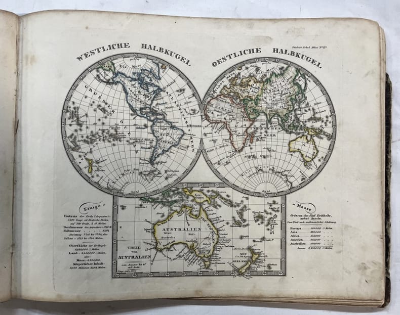
1850140962Gotha, Justus Perthes 1850 In-4à l’italienne 23,5 x 31 cm. Reliure demi-basane havane, dos lisse muet, 24 planches, table. Reliure défraîchie avec manque angulaire, coupes usées, intérieur correct. En l’état.
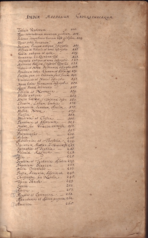
ORD-20145Brunsvigae, Typis Johannis Henrici Dunckeri, Sumpt. Thomae Henrici Hauensteinii. Bibliop. Hannov. & Hildesiensis. Anno M DC LXXI (1671). Petit in-f° (200 x 315 mm) dos et coins parchemin ivoire, plats cartonnés. Notre exemplaire s'ouvre sur 2 pages manuscrites notamment un Index Mapparum Geographicum qui répertorie la totalité des gravures du livre, la page de titre est précédée d'un grand nombre de feuilles vierges. Suvent une adresse a Generosis ac amplae adolescentibus Axelio a Lilienström & Axelio Bohlio, puis 26 pages de texte et 45 gravures hors texte dont 4 au format réduit (Rose des vents, Typus intervallorum variarum gentium, éclipses, Typus orbis terrarum) et 41 cartes en noir et blanc, la plupart sur double page, et ornées d'un cartouche. Soit 29 pour l'Europe, 8 pour l'Asie, 3 pour l'Afrique et 1 pour l'Amérique. Reliure irrécupérable, petit travail de vers en marge inférieure sans dommage pour les gravures.
Amsterdam, 1640 circa. Incisione in rame all'acquaforte, colore d'epoca, cm 38,8 x 51,5 (alla lastra), testo francese al verso. Tracce di umido e fioriture nella parte superiore del foglio, soprattutto lungo i margini.
New Turkish Paperback. Demy 8vo. (21 x 14 cm). In Turkish. 158 p., b/w ills. Savaslarda haritacilar. A list and biographies of military cartographers of the Ottoman Empire and Turkish Republic from Mehmed Sevki to Mehmet Neset. It includes 150 short biographies with battles their participated. A fine reference for Turkish cartography.
Very Good English Original folded color map. Oblong atlas folio. (60x91 cm). Bilingual in English and Arabic. Arabic map and texts with b/w photographs of some views from Saudi Arabia and English map and texts with b/w photos of Jeddah, Riyadh and Dhahran airports with legends and "distances in kilometers". It shows a very detailed landscape of entire Arabian Peninsula including Saudi Arabia, Aden, Oman, Muscat Qatar, Trucial Coast, Nafud, Dahna, Rub' Al-Khali, Najran, Asir, Yemen, Ramlat As Sab'atayn, Dhofar, Al Mahrah, Hadhramaut, Kuwait, Neutral Zone, and others.
Rarissima carta geografica dell'isola edita a Venezia da Ferrando Bertelli. Magnifico esemplare, rifilato al rame e con margini coevi aggiunti, in perfetto stato di conservazione.Descrizione della mappa presa da Bifolco & Ronca "CARTOGRAFIA RARA ITALIANA: XVI SECOLOL'ITALIA E I SUOI TERRITORI Catalogo Ragionato delle Carte a Stampa"http://www.antiquarius-sb.com/cartografiarara.aspTITOLO & ISCRIZIONIAl centro dell’isola, la scritta Sardegna; in alto, a sinistra, in una targa, una breve descrizione della regione, lafirma dello stampatore e la data, Sardinia jnsula inter africu[m] et tirrenum pelagus sita magnitudine 562 mil. pas: fertilis admodu[m] animaliuq varij generis abu[n]da[n]s metallis stagnis argentareijs fontibus salubris prestantissima. Fer. Ber. Exc. 1562. Orientazione nei quattro lati al centro, con il nome dei venti Tramontana, Mezzo di, Levante, Ponente. Carta priva di graduazione ai margini e di scala grafica.NOTIZIE STORICO-CRITICHELa carta del Bertelli è una derivazione della carta del Gastaldi-Licinio stampata qualche anno prima. Rispetto aquesta, non apporta novità dal punto di vista geo-cartografico. L’opera appartiene ad una serie di mappe delle isole del Mediterraneo occidentale (Sardegna, Corsica, Maiorca, Minorca) che Bertelli realizzò nel 1560 circa. È plausibile che il Camocio abbia usato la mappa, inserendola in una copia del suo Isolario.STATI & EDIZIONINon sono note ristampe.BIBLIOGRAFIA & CENSIMENTOR. Almagià, Monumenta Italiae Cartographica, 1929, p. 22; R. Almagià, Monumenta Cartografica Vaticana, 1948, pp. 103, 42; F. Borroni Salvadori, Carte Piante e Stampe Storiche delle raccolte Lafreriane della Biblioteca Nazionale di Firenze, 1980, p. 23, n. 61; Christie’s Londra, Cartography, 2006, 496; Christie’s New York, Books & Manuscripts, 2001, 54; Christie’s Roma, Libri, Autografi, Carte Geografiche, Ricordi familiari dei Duchi di Windsor, 2004; A. Ganado, Description of an early Venetian sixteenth century collection of maps at the Casanatense Library in Rome, pp. 26-47, 38; L. Lago, Imago Italiae, 2002, fig. 490; P.H. Meurer, The Strabo Illustratus Atlas, 2002, p. 6l, 47; L. Piloni, Carte geografiche della Sardegna, 1974, XXV, p. 58; R. Shirley, Maps in Atlases of the British Library. A descriptive Catalogue, pp. 381-384, 104; P. Tavernari, M. Donattini, Totius orbis descriptio: la collezione di carte geografiche delcardinale Alessandro d’Este, 61; R.V. Tooley, Maps in Italian Atlases ofthe Sixteenth Century, 1939, p.12-47, n. 510- 511; V. Valerio, L’Italia e le sue regioni nella bottega dell’incisore, 2008, p. 104-105, 43. Very rare map of the island, published in Venice by Ferrando Bertelli . Magnificent example, trimmed at the copperplate and with coeval margins added, in a perfect state of preservation.The map is a derivation of the work by Gastaldi & Licinio printed some years before, with some geographical news. The work belongs to a series of maps of the islands of the western Mediterranean (Sardinia, Corsica , Majorca, Menorca), that Bertelli realized around 1560. It is plausible that Giovanni Francesco Camocio have used the map, putting it in a copy of his Isolario.Literature: R. Almagià, Monumenta Italiae Cartographica, 1929, p. 22; R. Almagià, Monumenta Cartografica Vaticana, 1948, pp. 103, 42; F. Borroni Salvadori, Carte Piante e Stampe Storiche delle raccolte Lafreriane della Biblioteca Nazionale di Firenze, 1980, p. 23, n. 61; Christie’s Londra, Cartography, 2006, 496; Christie’s New York, Books & Manuscripts, 2001, 54; Christie’s Roma, Libri, Autografi, Carte Geografiche, Ricordi familiari dei Duchi di Windsor, 2004; A. Ganado, Description of an early Venetian sixteenth century collection of maps at the Casanatense Library in Rome, pp. 26-47, 38; L. Lago, Imago Italiae, 2002, fig. 490; P.H. Meurer, The Strabo Illustratus Atlas, 2002, p. 6l, 47; L. Piloni, Carte geografiche della Sardegna, 1974, XXV, p. 58; R. Shirley, Maps in Atlases of the British Library. A descriptive Catalogue, pp. 381-384, 104; P. Tavernari, M. Donattini, Totius orbis descriptio: la collezione di carte geografiche delcardinale Alessandro d’Este, 61; R.V. Tooley, Maps in Italian Atlases ofthe Sixteenth Century, 1939, p.12-47, n. 510- 511; V. Valerio, L’Italia e le sue regioni nella bottega dell’incisore, 2008, p. 104-105, 43. Bifolco & Ronca, L'Italia e le sue regioni, p.346, tav. 147.