JACQUIN, Nikolaus Joseph, Baron Von.Livre Rare Book
692 496 résultats
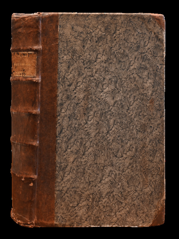
LCS-18499Exceptionnel exemplaire de haute bibliophilie à toutes marges, non rogné (hauteur: 378 mm) en reliure de l’époque. Vindobonae (Vienna), ex officina Krausiana, 1763. In-folio, (5) ff., vii pp., (5), 284 pp., (3) ff., (1) f.bl., 1 frontispice gravé, (4) ff., 184 planches dont 6 dépliantes. 1 cahier bruni. a-b4, c-c2, [1] - 284, [1] leaf, 184 planches et 1 frontispice (engraved emblematic frontispiece of Native Americans holding up a banner containing a map of the West Indies surrounded by Caribbean flowering plants and animals, engraved title vignette, and 2 headpieces, 184 engraved plates after Jacquin, including 6 folding, woodcut head-and tailpieces). Complet. Demi-basane à coins, dos à nerfs, pièce de titre en maroquin citron, à toutes marges, non rogné, qq. usures aux coiffes et aux coins. Reliure de l’époque. 378 x 240 mm.
20 x 13 inches. Hand-coloured. Fine example of De Jode's modern map of the Middle East, from his Speculum Orbis Terrae, published in Antwerp in 1578 and engraved by Joannes & Lucas van Deutecum. The complete title reads: "Secundae partis Asiae: typus qua oculis subijciuntur itinera nautarum qui Calecutium Indiae mercandorum aromatum caufa fre quentant, ac eorum quoqz qui terrestri itinere ade unt Suacham, Laccam, in domino Praeto Iani, nec non eorum qui Aden et ormum inuifunt, et Balsaram quoque castrum, supra Euphratem fluuium situm, omnia suis gradibus subiecta, cum longitudinis tum latitudinis / Iacobo Castaldo pedemontano authore; Gerhardus de Iode excudebat". As noted in the title, the map was prepared by Gerard De Jode's and is largely identical to Giacomo Gastaldi's highly influential map of 1559. De Jode's delineation of Arabia is vastly superior to the contemporary maps of Ortelius, showing far more accuracy and detail. Extending from the Nile to Afghanistan and centered on the Arabian Peninsula and the Gulf, the map depicts what was then still among the most important trading centers of the commercial world. The present example is from the first edition of De Jode's work, which can be distinguished from the second edition by the pagination on the verso (VII for the 1578 edition; 9 for the 1593 edition). The map is drawn from the rare first edition of De Jode's Speculum Orbis Terrarum. At least one commentator has opined that as few as 11 known examples of the first edition are known to have survived, making separate maps from this first edition very rare on the market. - Giacomo Gastaldi (fl. 1542-1565) is widely considered to be the most important and influential of all of the Lafreri School mapmakers. Born in Piedmont, Gastaldi worked in Venice, where he become Cosmographer to the Venetian Republic. Karrow described him as "one of the most important cartographers of the sixteenth century. He was certainly the greatest Italian mapmaker of his age..." While his achievement is obvious, it is hard to quantify. A large number of maps were published throughout this period with the geography credited to Gastaldi, but it is often difficult to know what role Gastaldi played in their creation. As a practice, he did not sign himself as publisher, although his name may be found in the title, dedication, or text to the reader. Frequently where there is no imprint one may assume that Gastaldi was the publisher. A further clue may be that many of the maps attributable to Gastaldi as publisher seem to have been engraved by Fabius Licinius. In other cases, where publication is credited to another, it is not always certain whether Gastaldi was commissioned by the publisher to compile the map, whether another less-enterprising publisher merely copied his work and attribution, or simply added Gastaldi's name in the title to add authority to the delineation. His name clearly commanded the same sort of respect that the Sanson name had in the last years of the seventeenth century, and as Guillaume de L'Isle's had in the first half of the eighteenth century. Gastaldi's first published map was of Spain, engraved on four sheets, and issued in 1544. The following year he published a map of Sicily, among the most widely copied of all his maps. In the course of a prolific career, Gastaldi subsequently produced a number of maps of Italy, and individual parts of the peninsula, with his general map of Italy, and the map of Piedmont also being very influential. Among the most important of his maps, however, were of areas outside Italy. Principal among these was his map of the World, published in 1546, a four sheet map of the countries of south-eastern Europe, published in 1559, and his series of three maps of the Middle East, Southern Asia, and South-East Asia with the Far East, issued between 1559 and 1561. In 1562, Gastaldi issued a two-sheet map of the Kingdom of Poland, and in 1564, a magnificent eight-sheet map of Africa. Karrow, Mapmakers of the Sixteenth Century, 30/91.2. Tibbetts, Arabia in Early Maps 38.
Large 8vo. XXII, (2), 500, (folding leaf of appendix) pp. With 27 (of 32) plates, mostly folded and coloured. Modern half calf with marbled paper boards. Red morocco label to gilt spine. First edition, very rare. The volume includes seven important historical, archaeological and geographical essays covering Baghdad, the Nahrwan canal and large parts of Kurdistan, the topography of Nineveh and the old course of the River Tigris. Also included are some 30 maps and plates, many in colour, most notably the ground-plan of Baghdad. Felix Jones first saw service on the Palinurus, surveying the northern part of the Red Sea, whilst a later commission found him engaged on the Arabian survey under Haines. In 1839 he surveyed the harbour of Graine (Kuwait) and this led to an almost continuous period of service in Mesopotamia and the Gulf, ending in 1862 as Political Agent in the Persian Gulf, in which capacity he planned the British invasion of Persia. - Lacks the large maps of the Katul es Kesrawi and River Tigris. Labels to spine chipped, spine faded, occasional blue pencil markings between pages 259 & 288, and between pages 364 & 368. Generally text and plates very clean and fresh, map at page 136 torn at fold with no loss. - No pocket is present in the rebinding nor are the 3 maps which the pocket should contain. Paper slightly browned, otherwise in good condition.
Small folio (237 x 308 mm). 2 vols. (6), IX, (1), VI, 665, (1) pp. (2), VI, 817, (13) pp. Contemporary full sheep, flat spines with red morocco labels. The "Mishkat al-Masabih" ("A Nic33357he for Lamps") of Al-Khatib al-Tabrizi (also known as Wali al-Din, d. 741 H), a revised and expanded version of the "Masabih al-Sunnah" by al-Baghawi, with approximately 1500 hadith added. This important Sunni text was first translated into English by Capt. Matthews of the Bengal Artillery. Although some of the original hadith are not included and others incorrectly translated, this attempt at publishing a translation from the Arabic was a noted accomplishment for the time. - The List of Subscribers accounts for 122 copies, with an additional 100 copies noted as being published on order of the Governor General in Council for the Honourable Company. A statement in an 1848 issue of the Journal of Sacred Literature suggests that most copies of the work were destroyed at sea, yet it was still advertised for sale in 1817 in the Literary Panorama (at the price of £4.4s). - Some browning throughout, more pronounced in endpapers. A short tear to lower edge of vol. 1. A good copy of this rare Calcutta imprint, bound in India. OCLC 15466515. BLC v. 229, p. 302.
Folio. 1 p. The letterhead reads "Agitational-Propagandist Department of the E.C.C.I., Moscou" in German, French, English, and Russian. Also included is an English translation of the letter and a typed dossier on Kun in English, dated 1931. A rare letter signed by one of the most notorious early Bolshevik leaders and a proponent of international communism. Béla Kun led the brutal and short-lived Hungarian Soviet Republic in 1919, oversaw the massacre of tens of thousands of people when he controlled the Revolutionary Committee in Crimea in 1920, and spurred the German Communist Party into an abortive uprising in March 1921. While he lost the active support of Lenin with this last failure, Kun continued to hold a number of significant positions in Comintern throughout the 1920s. He disappeared in 1937 in the midst of Stalin's Great Purge, and was shot as a Trotskyite in 1938, following a show-trial. - In this letter, Kun orders that future copies of specific publications (he lists "Rote Fahne, S.A.Z., Kämpfer, Ruhr-Echo, Schlesische A.Z., Volkswacht Mecklenburg, Klassenkampf") be sent to the central committee of Comintern's Agitprop department for scrutiny, in order to ensure better control and management of communist publications. As Kun explains, "Die Exekutive der K.I. stellte der Agitprop-Abteilung des E.K.K.I. die Aufgabe, die gesamte kommunistische Presse eingehend zu kontrollieren [...] Wir haben deshalb beschlossen, in einer Frist von 3 Monaten die wichtigsten Parteiorgane einiger Sektionen einer eingehenden Beobachtung und Kontrolle zu unterziehen [...]". Regarding the specific publications, Kun adds, "Wir bitten Euch, uns umgehend und regelmässig je drei Exemplare dieser Zeitungen zuzusenden." He signs off "Mit kommunistischem Gruss!". - Lightly worn and creased; insignificant tears to lower edge. A vanishingly rare signature.
Watercolour on paper, 290 x 460 mm, matted (600 x 398 mm). Beautiful orientalist watercolour, inscribed by the artist "à Monsieur Coullon, souvenir affectueux". Lacoste, a genre painter equally adept at landscapes and architecture, was a student of Rouillet, Cambon, and Cogniet. He exhibited at the Salon from 1839 to 1907, also drawing costumes for the various Parisian scenes, including for the Opéra from 1876 to 1885. His series of watercolours painted for Verdi's "Aida" in 1880 is remarkable; a design for "Ramses" is now kept at the Getty Museum. The present orientalist scene is typical of its age but distinguished by its large format and masterly quality. It shows a Middle Eastern oasis with Moorish-type buildings near a palm grove reflected in a waterhole, surrounded by eight characters in local costumes going about their lives: a man is perched on his camel; two men are wearing red hats; two women, possibly slaves, carry jugs on their heads. In the foreground, cargo unloaded from a camel suggests a Bedouin desert stopover. - Slight foxing and waterstaining to matte, not concerning the painting.
LCS-18619Précieux et fort bel exemplaire royal de l’auteur, sur grand papier, relié en maroquin rouge de l’époque aux armes et pièces d’armes du roi de Pologne, Stanislas Leszczinski. (1677-1766). Paris, 1763. 4 volumes in-8, maroquin rouge, triple filet doré encadrant les plats, armoiries frappées or au centre, dos à nerfs ornés de pièces d’armes dorées, pièces de titre et de tomaison de maroquin olive, filet or sur les coupes, roulette intérieure dorée, doublures et gardes de tabis bleu, tranches dorées. Reliure armoriée de l’époque. 196 x 122 mm.
4to. (14), 591, (23) pp, final blank. With additional engr. title page (frontispiece), 4 full-page text woodcuts (2 folding) and several smaller woodcuts in the text, as well as 1 folding woodcut plate, latterly backed with cloth. Sumptuous mid-19th-century three quarter morocco binding with gilt spine. Extremely rare and early edition of this great English hippiatric manual, first published in 1615, by one of the earliest Western owners of and dealers in Arabian horses. A distinctly modern touch is provided by the small woodcut pointing hands scattered about the margins, denoting new cures and "medicines that are most certaine and approved; and heretofore never published". Gervase (Gervais, Jarvis) Markham, as well as his father Robert, a Nottinghamshire MP and Sheriff, was the owner of valuable horses, and "is said to have imported the first Arab. In a list of Sir Henry Sidney's horses in 1589 'Pied Markham' is entered as having been sold to the French ambassador [and it, or a horse of the same name, may have been given to Markham by Sir Francis Walsingham], and Gervase sold an Arabian horse to James I for £500" (DNB). - Variously browned; occasional corner faults (no loss to text). From the library of Sir Robert Throckmorton, Bt. (1800-62), member of an eminent Anglo-Catholic noble family who sat in the House of Commons from 1831 to 1835 (his bookplate on front pastedown; a later bookplate is opposite on the flyleaf). Wing M659. Poynter 20.7. Wellcome IV, 56 (incomplete). Cf. Mennessier de la Lance II, 156. Huth p. 17 (other editions).
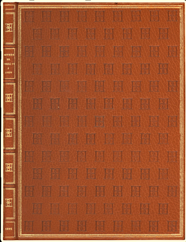
LCS-18451Œuvre de Pierre Matthieu, historiographe du «bon roi Henri». A Lyon, De l’Imprimerie de Pierre Michel. Avec privilège. 4 septembre 1595. In-4 de (4) ff. titre compris, 104 pages, 1 portrait à pleine page et 1 grande planche double. Maroquin caramel, triple filet doré, chiffre répété en semé sur les pats, dos orné du chiffre répété, doublure et gardes de moire chocolat (Honegger). 258 x 187 mm.
Folio (490 x 375 mm). (2), 70 pp. With lithographed title-page and 48 lithogr. plates. Contemporary giltstamped half calf. Rare, elaborately produced publication about Maximilian's journey to Egypt, Nubia, Palestine, Syria, and Malta, on which he was accompanied by the artist Heinrich Mayr. The harem and market scenes are obviously indebted to the French orientalist tradition; several plates show details of architecture, costumes, camel and horse care, etc. They are not identical with the better known plates in Mayr's earlier "Malerische Ansichten aus dem Orient" (Leipzig 1839). - Spine professionally rebacked. Foxing throughout, mainly confined to the plates' margins. Blackmer 1101 (French ed.). Ibrahim-Hilmy II, 26. Tobler 161. Rohricht 1871. Lipperheide Ma 28 (French ed.). Thieme/B. 477 (citing 36 plates only). Kainbacher 299, 2 ("RR").
4to. 12 double-page maps with accompanying Latin text, head- and tailpieces. Contemporary decorated calf gilt. Johannes Matalius Metellus (ca. 1517-97) was a French jurist who spent his early life travelling in Italy. Later Metellus moved to Louvain. Around 1579, he became involved in Cologne's cartographic publishing industry, when he is thought to have contributed to the "Itinerarium Orbis Christiani". He also contributed a description of Lyon to Braun & Hogenberg's "Civitates Orbis Terrarum". There is a very attractive map of Arabia. "His map of Japan is the earliest known copy of Teixeira's map, which had appeared in Ortelius" (Walter 20). Metellus was a friend of Matthias Quad, whose name is sometimes associated with the posthumous completion of the Metellus atlas of the Americas (it was published in 1598; Metellus is thought to have died in 1597). The cartographer was also in correspondence with Abraham Ortelius. At one point he gave Ortelius assistance collating Ptolemy's Cosmography with manuscripts in the Vatican. This was evidently needed for the completion of Ortelius's "Parergon Theatri". - Minor foxing generally not affecting maps, minor worming. Al-Qasimi 36. Tibbetts 59. H. P. Kraus, Monumenta Cartographica, items 45 & 52.
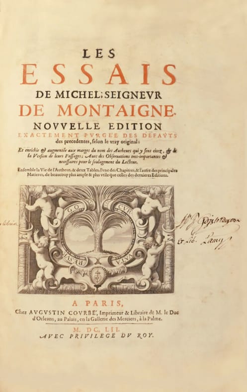
LCS-186411Année 1652. Paris, chez Augustin Courbé, 1652. In-folio de (16) ff. y compris un frontispice, 834 pp. (mal ch. 840), (21) ff., pt. manque de papier au coin de la p. 523 sans atteinte au texte. Plein veau moucheté de l’époque orné à la Du Seuil, dos richement orné, tranches marbrées. Reliure de l’époque. 383 x 260 mm.
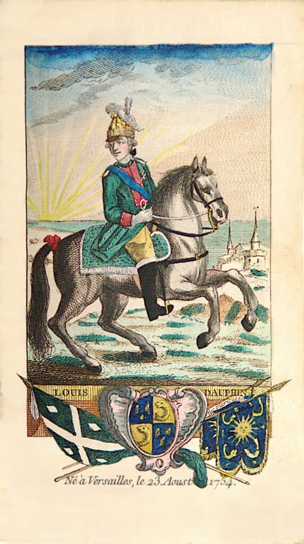
LCS-18068De la bibliothèque du Docteur Bernard. Se vend à Paris, chez l’Auteur, 1772. In-12 de (3) ff., 4 planches de portraits royaux, 170 planches de cavaliers numérotées 169, 1 planche avec les noms des couleurs et métaux, (2) ff. de table. Maroquin rouge, triple filet doré encadrant les plats, dos à nerfs orné, filet or sur les coupes, roulette intérieure, tranches dorées. Reliure de l’époque. 158 x 91 mm.
Folio (202 x 330 - 214 x 325 mm). Together 39 pp. Three typescript drafts in French and English of the 1957 Petroleum Act, a pioneering document of contractual relationships in the oil industry. The personal copies of Fuad Rouhani (1907-2004), later the first Secretary General of OPEC, with his annotations. - In the years immediately following the signing of the 1954 Consortium Agreement, the historic agreement that provided Western oil companies with 50% ownership in Iranian oil production, the fledgling national Iranian oil Industry received an enormous moral boost from the exploration activities conducted around Qom. The discovery of the Alborz oilfield and the Sarajeh gas field by the Iranian Oil Company not only proved Iran's growing technical capacity but it also helped to give Iran a prestige not hitherto enjoyed by any other oil producing and exporting country. Against this background it is therefore hardly surprising that when Enrico Mattei, the Chairman of ENI (the Italian State Oil Company), decided to look for oil supplies in the Middle East by offering new contractual terms, he should turn to Iran and that the government of Iran and the NIOC should greet him with open arms. What had prompted Mattei to come forward with the participation formula was his resentment at the treatment he had received from the major oil companies by being excluded from the Consortium Agreement. Since access to crude oil resources was of utmost importance for Italy and ENI, a way had to be found for entry into the Middle East oil scene. NIOC and ENI thus pioneered a new form of contractual relationship, thereafter known as 75/25 profit sharing, breaking the hallowed fifty-fifty arrangement and heralding a new era in international oil agreements. - Traces of stapling; margins somewhat worn.
Large folio (295 x 479 mm). 2 vols. (12), XXXIV, 124 pp. (4), VIII, 155, (1) pp. With engraved frontispiece, engraved portrait, 19 engraved vignettes, 10 engraved initials, and 162 engravings on 161 plates. Modern half cloth. First English edition of one "of the earliest modern studies of Egypt" (Howgego). - "The first map of the Nile between Cairo and Derr based on autopsy, indicating all locales on the river banks" (cf. Henze). The engravings show views, landscapes, ruins, antiquities, plans, and maps. Plates numbered I through CLIX; plates XVI, XXII and XVII are followed by an unnumbered plate; illustrations CXL/CXLI and CXLII/CXLIII are printed from a single plate; no. CVIII is printed from two separate plates and is not joined to form a single illustration (thus counted as two plates). - Some edge repairs near beginning and end; several plates trimmed closely. All plates stamped "Birmingham Library". Endpapers show traces of a removed bookplate, as well as a later bookplate (apparently "Fritz Machac") in hieroglyphs. Howgego I, N38. Weber II, 520. Ibrahim-Hilmy II, 74. Cox I, 382. Brunet IV, 101. Graesse IV, 687. OCLC 5716565. Cf. Gay 2169. Henze III, 622. Paulitschke 746. Blackmer 1212 (2 volumes in one).
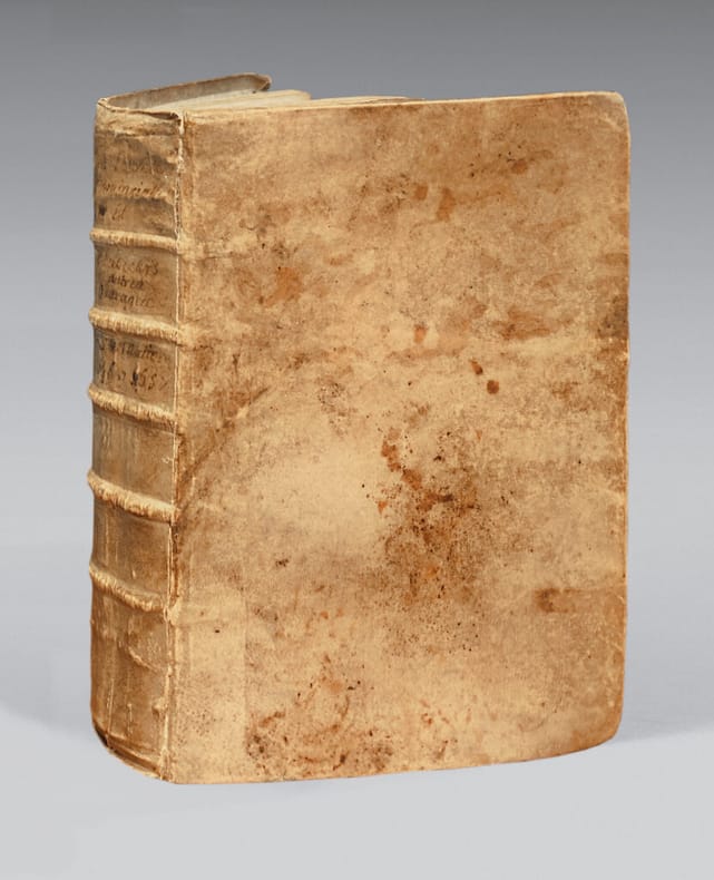
LCS-186412Cologne, Pierre de la Vallée, 1657. - Suivi de nombreuses pièces de controverses philosophiques, théologiques et religieuses s'échelonnant de 1655 À 1658, et d'une pièce de 1748. Table des pièces calligraphiée à l'époque sur les ff. préliminaires et portrait du Père Antoine Escabar, Théologien de la Compagnie de Jésus, ajouté. Ensemble 1volume in-4, vélin. Reliure de l'époque. 237 x 175 mm.
Folio (235 x 320 mm). 2 vols. in one. (58), 614, (42) pp. (12), 632, (86) pp. Elaborate woodcut device on title-page; woodcut initials, head- and tailpieces. Contemporary calf, spine in six compartments, tooled and lettered in gilt. Pliny's renowned Natural History in its second publication in English (repeating, with corrections, the 1601 first publication), translated by Philemon Holland, the greatest translator of the Elizabethan age. The "Naturalis Historia" is one of the largest single works to have survived from the Roman empire to the modern day and purports to cover the entire field of ancient knowledge, based on the best authorities available to the author. Pliny claims to be the only Roman ever to have undertaken such a work. It comprised 37 books in 10 volumes and covered over 20.000 facts on topics including the fields of botany, zoology, astronomy, geology and mineralogy as well as the exploitation of those resources. It remains a standard work for the Roman period and the advances in technology and understanding of natural phenomena at the time. Some technical advances he discusses are the only sources for those inventions, such as hushing in mining technology or the use of water mills for crushing or grinding corn. Much of what he wrote about has been confirmed by archaeology. "We know from Pliny that there were important pearl fisheries in the Gulf [...] Pliny identifies Tylos (Bahrain) as a place famous for its pearls [... He] attests that pearls were the most highly rated valuable in Roman society, and that those from the Gulf were specially praised [...] The pearl related finds at the site of El-Dur indicate the site was integrated into the maritime trade routes linking the Roman Empire, the Persian Empire, India and South Arabia" (Carter). Book 6 holds a chapter that gives the first detailed account of the regions around the Gulf, including what are now Qatar, the Emirates and Oman. - Binding rubbed; front hinge splitting. Includes the final printed leaf in vol. 2, containing the publisher's advertisement to the reader that all errors have been corrected in the present edition and the errata leaf (included in the same position in 1601) has become unnecessary rather than having been mistakenly omitted. Some slight browning and brownstaining, but an excellent copy removed in 1973 from the Royal Meteorological Society (Symons Bequest, 1900) with their bookplate on the front pastedown. STC 20030. Cf. Pforzheimer 496 (1601 ed.).
4to. 3 vols. (in 6 parts) bound as 6. XXXVI, 219, (1), (11), 224-491, (1) pp. (12), 262 pp., (1 blank f.), VIII, (3), 268-376, 397-519, (1) pp. VIII, 262 pp., (1 blank f.), VIII, (3), 268-403, (1) pp. (4), 115, (1), 124 pp. With 205 engraved folding plates (irregularly numbered I-CIII), including maps, plans, views and other illustrations, depicting temples, antiquities, plants, animals, etc. Contemporary half calf, gold fillets and two title-labels on spines, sprinkled paper sides. First edition of the Dutch translation of Pococke's celebrated monograph on the Near and Middle East, praised by Gibbon as a work of "superior learning and dignity" (Decline and Fall, ch. 11, n. 69). This Dutch edition was augmented with 27 plates, an essay by the minister Rutger Schutte on the travels of the Israelites, and a index to Biblical locations found in the main work. - "Pococke travelled extensively in Europe from 1733 to 1736 and continued on to the Levant, reaching Alexandria in September 1737. He remained three years in the Eastern Mediterranean, visiting Egypt, Palestine, Asia Minor and Greece. His book describes these journeys but not necessarily in chronological order. The plates of antiquities are after drawings by Pococke himself ... Pococke achieved a great reputation with this publication; the work was very popular during his lifetime and was praised by Gibbon" (Blackmer). "The quality and particularly the earliness of his observations and their record in prose, maps, and diagrams make him one of the most important near eastern travellers, ranking with Frederik Ludvig Norden and Carsten Niebuhr, in stimulating an Egyptian revival in European art and architecture, and recording much that has subsequently been lost" (ODNB). - A couple of plates in the last volume slightly browned and a few spots on the first few leaves of the first volume, otherwise a very good copy, with the leaves nearly untrimmed. The bindings somewhat rubbed along the extremities (primarily the spines), but otherwise good. Cox I, 224. Tiele, Bibl. 869. Cf. Blackmer 1323 (English ed.); for the author: Baigent, "Pococke, Richard (1704-1765"; in: ODNB (online ed.).
Folio. 31 tinted lithographed plates, all with partial hand-colouring. Contemporary red half morocco gilt. Second edition of one of the most sought-after and earliest publications by Prisse d'Avennes, who spent many years in Egypt after 1826, first as an engineer in the service of Mehmet Ali. After 1836 he explored Egypt disguised as an Arab, using the name Edris Effendi; during this period he carried out archaeological excavations in the valley of the Nile. In 1848 he first published his "Oriental Album". This unusual visual collection of "characters, costumes and modes of life in the valley of the Nile" is augmented by a commentary by the renowned orientalist and Egyptologist James Augustus St. John. - The frontispiece portrait depicts the artist's friend George Lloyd in the robes of a sheikh reclining with a hookah, and camels in the background. Lloyd, a botanist accompanying the expedition, accidentally shot himself whilst cleaning a rifle. - Light foxing, affecting some plates, with 2 plates trimmed at foot and laid down. Atabey 1001. Blackmer 1357. Colas 2427. OCLC 4423031. Cf. Brunet IV, 885 (1st ed. only). Heritage Library, Islamic Treasures, s. v. "Art" (illustration). Not in Abbey. Lipperheide Ma 30 (1st ed.).
LCS-A33«Pour un esprit philosophique, c’est-à-dire un esprit préoccupé des origines, il n’y a vraiment dans le passé de l’humanité que trois histoires de premier intérêt : l’histoire grecque, l’histoire d’Israël, l’histoire romaine. Ces trois histoires réunies constituent ce qu’on peut appeler l’histoire de la civilisation». (E. Renan) Paris, Calmann Lévy, 1887-1893. 5 volumes in-8 : I/ (1) f.bl., (2) ff., xxix pp., 455 pp. ; II/ (2) ff., iv pp., 545 pp., (3) pp. bl. ; III/ vii pp., 527 pp. ; IV/ (2) ff., 411 pp. ; V/ (2) ff., 427 pp., grand papier japon, demi-maroquin bleu à coins, têtes dorées, couvertures oranges et dos conservés. Reliure signée P. L. Martin. 242 x 153 mm.
8vo. Letterpress title page and 40 engr. plates by James and Henry Roberts, engr. index leaf, and publisher's 4-page catalogue (with woodcut image of cocks fighting). Stitched in wrappers. Fine series of plates, each depicting a famous horse with his rider or stable-hand, and recording its pedigree, qualities and racing record, together with the owner's name. The final plate shows the most famous of all, the Godolphin Arabian (here called the "Bay Arabian, the property of the Right Hon.ble the Earl of Godolphin"), foaled in Yemen around 1724: "This extraordinary horse became a private stallion soon after his arrival in this kingdom, and got a greater number of fine horses of just temper with superior speed than any Arab ever did. He was the Sire of Lath, Dismal, Cade, Bajazet, Babraham, Phenix, Dormouse, Regulus, Skewball, Sultan, Blanck, Slugg, Noble, Tarquin, Blossom, the Godolphin Gelding, Shepherdess, Amelia, and many others besides stallions and brood mares, all in the highest esteem; he dies at Hogmagogg Hills, Dec. 1753, in the 29th year of his age". - Among the other horses are Lath, the Godolphin Arabian's offspring by Roxana; Basto (son of the Byerly Turk); Old Scar, whose ancestry included the Oglethorpe Arabian and Darcy's Yellow Turk, etc. The horses pictured all ran between 1708 and 1755. The first edition was published in about 1760, and this Barker edition some forty years later. This copy has no watermarks, but the books listed in J. Barker's catalogue of publications were mostly published in the 1790s. - Spine rubbed and bumped; slight wear to edges and corners. An excellent copy with two small tears imperceptibly restored. Of the utmost rarity: the only copy recorded at auction during the last decades is the Gloucester copy (Christie's, Jan. 27, 2006, lot 592). Huth, p. 38. Cf. Podeschi 54.
8vo (223 x 148 mm). 40 engraved plates, some with vignette at foot, engraved index leaf. Modern olive green morocco gilt by Eighton, covers with triple gilt fillet, spine in six compartments, gilt lettered direct in second, others richly gilt, raised bands, top edge gilt. Fine series of plates, each depicting a famous horse with his rider or stable-hand, and recording its pedigree, qualities and racing record, together with the owner's name. The final plate shows the most famous of all, the Godolphin Arabian (here called the "Bay Arabian, the property of the Right Hon.ble the Earl of Godolphin"), foaled in Yemen around 1724: "This extraordinary horse became a private stallion soon after his arrival in this kingdom, and got a greater number of fine horses of just temper with superior speed than any Arab ever did. He was the Sire of Lath, Dismal, Cade, Bajazet, Babraham, Phenix, Dormouse, Regulus, Skewball, Sultan, Blanck, Slugg, Noble, Tarquin, Blossom, the Godolphin Gelding, Shepherdess, Amelia, and many others besides stallions and brood mares, all in the highest esteem; he died at Hogmagogg Hills, Dec. 1753, in the 29th year of his age". - Among the other horses are Lath, the Godolphin Arabian's offspring by Roxana; Basto (son of the Byerly Turk); Old Scar, whose ancestry included the Oglethorpe Arabian and Darcy's Yellow Turk, etc. The horses pictured all ran between 1708 and 1755. The first edition was published in about 1760. Rare, only two copies recorded in ABPC/AE Online. ESTC records two issues, one published and sold by Henry Roberts, the other printed for R. and R. Baldwin (as here): just one location is given for the first issue (Winterthur), and one for the second (BL). Huth records the work under a variant title, and also notes an 1820 edition. - Plate 12 shorter at margins, some spotting and browning, heavier at margins. A most handsome copy. Huth 38.
4to. 116 ff. With 26 illuminated miniatures. Native paper heavily gilt, illuminated in a fine calligraphic hand, with attractive borders. Decorated cloth. A highly interesting Persian manuscript in Nastaliq style containing the two major works of the celebrated Persian poet (1184-1291). "Gulistan" ("The Rose Garden", 1258) and "Bustan" ("The Orchard", 1257) are both filled with semi-autobiographical stories, philosophical meditations, pieces of practical wisdom, and humorous anecdotes and observations, depicted in 26 miniatures in this manuscript. - Binding rubbed and chafed, spine damaged. Some of the miniatures slightly rubbed.
Folio (full-sheet leaves, 54 x 36.5 cm). Lithographed frontispiece, title-page & dedication plus 5, [1 blank] pp. plus plates. With a lithographed frontispiece portrait of Sale by Thomas Fairland after a painting by Scarlet Davis, a lithographed illustrated title-page, a lithographed dedication to Queen Victoria (reproducing Sale's hand-written and signed dedication), a double-page "Plan of Jellalabad" (51.5 x 60 cm, lithographed by S. Leith in Edinburgh) and 34 tinted lithographic views of the city and its fortifications (in landscape format) on 22 leaves (10 full-page, 2 half-page and 11 pair of oblong half-page, numbered 1-11, showing the fortifications before and after repairs and improvements). All leaves are unwatermarked wove paper, the frontispiece on fine "India" paper mounted on thick paper, the plan on thin paper and all other lithographs on thick paper, that of the title-page grey. With a guard-leaf bound in facing each plate. All lithographs were probably printed by Hullmandel & Walton, though only the frontispiece and title-page name them. Gold-tooled red goatskin morocco, on 5 recessed supports (not aligned with the 6 false bands on the spine), each board with a frame of 3 gold double fillets alternating with 2 blind single fillets, with the title and author on the front board and the 2nd and 4th of 7 spine compartments, richly gold-tooled turn-ins, gold-tooled board edges, yellow endpapers, gilt edges, blue and white headbands. The first and only edition of a grand and spectacular visual presentation (there are only five pages of text) of the city of Jalalabad and its fortifications in eastern Afghanistan and related sites as far away as Kabul. The illustrated title-page (image size 45 x 35 cm) shows the tower known as Alexander's Column, with mountains and clouds in the background and several people at its foot (including two on horseback in the foreground: a British officer and turbaned man), the whole framed by palm trees, other plants and military attributes, with the title in grey sans-serif and slab-serif capitals with a white drop-shadow. The first 11 leaves of views (2 half-page and 10 full-page, the latter mostly with image size 26.5 x 37 cm) offer meticulously detailed views of sites in and related to Jalalabad, including four in and around Kabul. These show the architecture (including minarets, fortifications and the building where the British were held prisoner) as well as British and Afghan people engaged in military activities and trade. The 11 numbered plates that follow show two panoramas each (nos. 1 and 10 reproducing a hand-written caption) showing Jalalabad's fortifications before (below) and after (above) the repairs and improvements undertaken by Sale. A red line in the upper views indicates the parts that had been destroyed by an earthquake. - Although the title-page attributes the entire work to Robert Sale, the text begins with an account of the city and battle by Hamlet C. Wade, who served under him, followed by "Lady [Florentia] Sale's narrative of her prison & fellow prisoners" and eight short texts giving an account of the view on the title-page and those in the first 10 leaves of views (the 4th to 6th together and the 9th and 10th together), that for the third signed by Florentia Sale. - The grand presentation, the portrait of the author (Major General Robert Sale, who commanded the troops at Jalalabad during the 1842 battle) and the dedication to Queen Victoria suggest this volume commemorates a great success, but in fact it was only a minor and short-lived reprieve in Great Britain's foolish and disastrous First Anglo-Afghan War (1839-1842). In 1839 Great Britain hoped to put Afghanistan back under colonial control by invading it and taking Kabul, ignoring the Duke of Wellington's prescient warning that it was a foolish move, and that they would find it much more difficult to hold Kabul than to take it. The British grossly underestimated the strength of the opposition, the difficulty of the terrain and the country's anti-colonial sentiment. Forced to abandon the city after an uprising in 1841 they tried to retreat to Jalalabad but nearly all the British troops and their entourage were slaughtered in the treacherous mountain passes. Sale's troops, who futilely awaited them in Jalalabad, were surrounded and attacked by the Afghans but managed to defeat them and drive them back to Kabul. - Various sources speculatively date the present publication from ca. 1842 to ca. 1846, but at least in the present copy a footnote on the first page of the letterpress text says, "Since this has been put to press … Sir Robert Sale has gloriously fallen in the battle of Moodkee, fought 18 December, 1845 ... he was struck by a grape shot which ... proved mortal shortly after he received the wound". He died on 21 December, so the book must have been published in the last 10 days of 1845 or early in 1846. Although printed on unwatermarked wove paper, the letterpress leaves show point holes in the centres of the fore-edge and gutter margins, showing that each leaf was separately printed and each is almost certainly a whole sheet, probably of Demy format. - With an armorial bookplate showing the crest and motto ("sans changer") of the Earls of Derby, probably the 14th Earl, Edward George Geoffrey Smith-Stanley (1799-1869), Conservative Prime Minister three times in the years 1852-68. With minor foxing, slightly more in the frontispiece and much more in one full-page plate (Baba's garden, whose paper is not as thick as the others), but otherwise in very good condition. The frontispiece (together with the 2 preceding free endleaves) has separated from the bookblock, the hinges have been restored and the binding shows a few scuff marks, but the binding remains in good condition. Magnificent and detailed tinted lithographs of buildings, fortifications, terrain and life in and around Jalalabad (and Kabul) in Afghanistan ca. 1845. Thomson, The exotic and the beautiful (Bobins coll.) 268. WorldCat (3 copies?). Not in Abbey, Travel.
LCS-18568Exemplaire dédicacé par l'auteur à Ferdinand-Philippe, duc d'Orléans, fils ainé du Roi Louis-Philippe Ier et Prince Royal. Paris, Rapilly, 1828-1829. 6 volumes in-8. Demi-veau à coins, dos à nerfs ornés de filets et roulettes dorés, pièces de titre et de tomaison de maroquin citron, tranches marbrées. Reliure de l'époque de Meslant. 205 x 130 mm.