GOZZANO GuidoMareMagnum

54 252 résultats
In-4 p., legatura edit. in brossura con carta a tino avorio, al piatto anter. titolo in viola e una litografia in nero, astuccio, pp. 118,(6). Scelta di 13 liriche di Guido Gozzano (nell'edizione orig.), con 17 pregevoli litografie a colori nel testo e una in nero sulla copertina, disegnate dal pittore Renato Cenni e tirate da Piero Fornasetti a Milano. Stampato con carattere Bembo per “I Cento Amici del Libro”, in tiratura di 120 esempl. numerati su carta a tino Fabriano di cui 100 “ad personam”, tutti firmati dal Presidente della Società. Cfr. Cat. Mardersteig,108: “Trattasi della prima edizione in cui appare la nuova sigla “CAL” incisa da Bruno Bramanti. Da questo momento essa sarà stampata in tutti i libri dei Cento Amici del Libro”. Il ns. esempl., “ad personam”, è in perfetto stato.
0410-Bo.J. Radierung, ?del. 1816?, auf Velin. 18,5:16,5 cm. Provenienz: Privatsammlung Kassel. Literatur: Stoll 206, III (von III), Nummer sichtbar getilgt. - Sehr guter Abdruck, vollrandig, etwas vergilbt. Über seinen Ausflug nach Tivoli während seiner Italienreise notiert Grimm: ?Tivoli liegt malerisch (?). Wir und der alte Müller (gemeint Maler Friedrich Müller, sind viel bergauf, bergab geklettert, er war immer voran und wußte alles auswendig. Wir zeichneten viel nach der Natur.? (Stoll, S. 248 f.).
135-Io.J. Bleistift, leicht aquarelliert und mit Deckweiß gehöht, auf bräunlichem Papier, links unten signiert und datiert ?Jean Großgasteiger. 1847.?. 23,8:33,4 cm. Schwacher Lichtrand ringsum, im Bereich des Himmels etwas braunfleckig. Dem Zeichner kam es auf topographische Genauigkeit an, deshalb vermuten wir, dass die Zeichnung als Vorlage für eine Graphik, Stahlstich oder Lithographie, gedacht war.
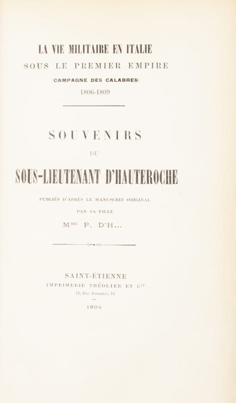
205191Saint-Étienne, Théolier et Cie, 1894 in-8, 333 pp., demi-maroquin brun à coins, dos à nerfs, tête dorée (Rousselle).
603-Eo.J. Bleistift, auf Velin, links unten bezeichnet, monogrammiert und datiert ?Lago di Nemi GJ. Settembre 1836?. 22,4:31,4 cm.
1790113203Genève [Paris], s.n., 1790, 7 vol. in-8°, un tableau généalogique dépliant hors texte (Maison de Médicis), reliures plein veau marbrés, dos lisse à fleurons dorés, pièces de titre et de tomaison basane carmin et noire, coupes guillochées, tranches marbrées (rel. de l’époque), bon état
089-Io.J. Bleistift auf Bütten, links unten signiert, betitelt und datiert ?Julius Lange Collico (sic!) Castello di Fuentes 23.Sept.1856.?. 26,2:39 cm.
Delineata sulla scia della più grande veduta di Jeremias Wolff, l’opera offre quaranta riferimenti topografici. Il Leopold, era un modesto incisore ed editore di Augsburg; la sua serie di vedute di città, da cui questa incisione è tratta, venne pubblicata con pochissima tiratura, rendendo quindi le opere particolarmente rare. Incisione in rame, in ottimo stato di conservazione. In the wake of Jeremias Wolff’s bigger view, this work presents many topographical references. Leopold was a modest engraver and publisher in Augsburg; the series of city views, from which this one is taken, has been published in a very limited circulation, which means these works are very rare. Copperplat, in excellent condition.
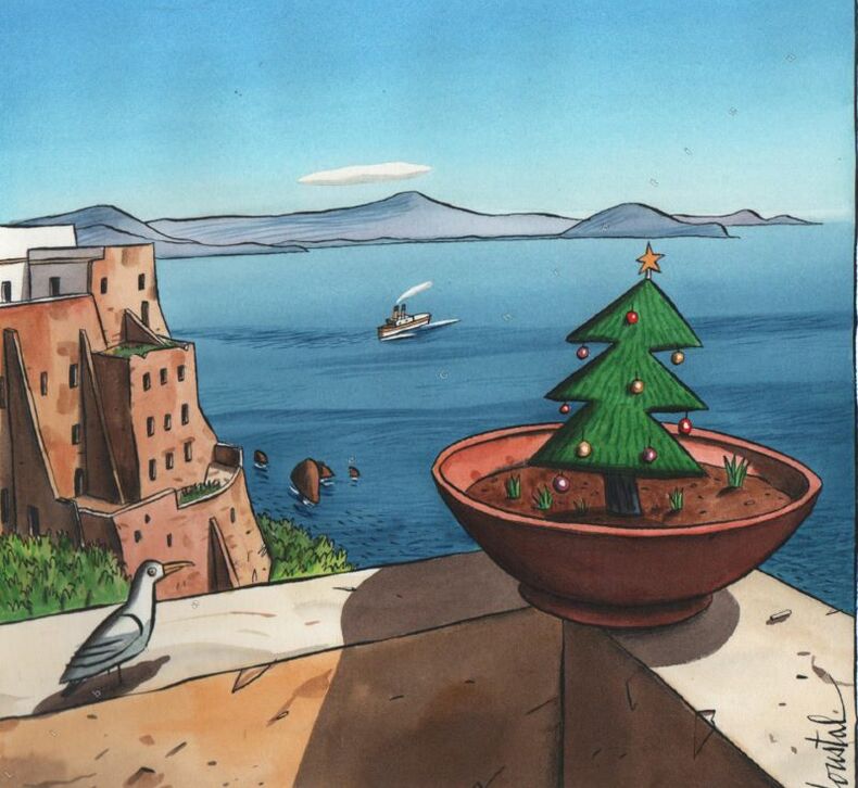
2009232582009 Maquette originale signée en bas à droite, encre de Chine et aquarelle, 2009, 22 x 24.3 cm. (format à vue), 25.6 x 27.4 cm. (format de la feuille).
Carta geografica tratta dal rarissimo Itinerarium Europae Provinciae edito a Colonia tra il 1579 e il 1588. Conosciuto anche come Itinerarium Orbis Christiani, questo atlante fu pubblicato anonimamente a causa dei problemi politici e religiosi che caratterizzavano il periodo storico, come spesso succedeva aal'epoca per sfuggire alle persecuzioni cattoliche contro i protestanti. L'opera fa parte degli atlanti editi dalla cosidetta scuola Cartografica di Colonia, durata per circa mezzo secolo (1570-1620 ca.), e formata principalmente da rifugiati fiamminghi ed olandesi tra i quali spiccano lo stesso Matthaeus Quad e Frans Hogenberg, che ne fu il fondatore. Le mappe sono attribuite alcune a Jan Matal ed altre a Michael von Eitzing. Jan Matal o Metellus, francese di nascita ed attivo a Louvaine ed a Colonia, dove si rifugia prprio per sfuggire alle persecuzioni dei regnanti cattolici e dove muore nel 1597. Fu tra i maggiori cartografi del tempo e, insieme al Quad e al Hogenberg stesso, il principale esponente della scuola coloniese. Alcune delle mappe del Matal sono poi successivamente incluse nelle successive pubblicazioni postume, e recano il testo al verso. Dal punto di vista cartografico le mappe sono una derivazione e basate sulle carte pubblicate ad Anversa da Abraham Ortelius, per la prima volta nel 1570; le incisioni delle mappe sono invece attribuite a Frans Hogenberg. La grandissima rarità dell'opera, insieme alla scarsità di informazioni sulle opere "carbonare" edite a Colonia, contribuisce al fascino di questa importante mappa, caposaòdo di ogni collezione cartografica. Incisioni in rame, magnifica coloritura coeva, in buono stato di conservazione. Opera di incredible rarità, mancante in praticamente tutte le collezioni. Esemplare di primo stato, avanti il numero. Map from the very rare Initerarium Europae Provinciae, published in Cologne between 1579 and 1588. Also known as Itinerarium Orbis Christiani, this atlas was published anonymously due to the political and religious problems that characterized that particular period, i.e., the persecutions suffered by the Protestants who were threatened by the Catholics. The work belongs to the atlases published by the so called Cartographic school of Cologne, whose works were published along fifty years (1570-1620). The school was mainly made of Flemish and Dutch refugees among which Mattheaus Quad and Frans Hogenberg, the founder of the institution. The maps have been ascribed to Jan Matal and Michale von Eitzing. Jan Matal, or Metellus, was born in France and worked in Louvaine and Cologne, where he fled to escape the Catholic persecution and where he died in 1597. He was considered one of the greatest cartographers of his time and one of the most important artists of the school of Cologne, together with Quad and Hogenberg. some of his maps have been afterwards included in some posthumous works with the text on verso. From a cartographic point of view, the maps derive from those published by Abraham Ortelius in Antwerp in 1570; the engravings instead have been ascribed to Frans Hogenberg. The rarity of this work, together with the lack of information on the secret works published in Cologne confer a particular charm to this map, a bench mark for every collector. Copper engravings, magnificent contemporary colours, in very good condition. Extremely rare work, not present in any collection. Example in the first state, before the number was added. Meurer Atlantes Colonienses Die Kolner Schule der Atlas Kartographie 1570-1610; Meurer IOC 8
Carta geografica tratta dal rarissimo Itinerarium Europae Provinciae edito a Colonia tra il 1579 e il 1588. Conosciuto anche come Itinerarium Orbis Christiani, questo atlante fu pubblicato anonimamente a causa dei problemi politici e religiosi che caratterizzavano il periodo storico, come spesso succedeva aal'epoca per sfuggire alle persecuzioni cattoliche contro i protestanti. L'opera fa parte degli atlanti editi dalla cosidetta scuola Cartografica di Colonia, durata per circa mezzo secolo (1570-1620 ca.), e formata principalmente da rifugiati fiamminghi ed olandesi tra i quali spiccano lo stesso Matthaeus Quad e Frans Hogenberg, che ne fu il fondatore. Le mappe sono attribuite alcune a Jan Matal ed altre a Michael von Eitzing. Jan Matal o Metellus, francese di nascita ed attivo a Louvaine ed a Colonia, dove si rifugia prprio per sfuggire alle persecuzioni dei regnanti cattolici e dove muore nel 1597. Fu tra i maggiori cartografi del tempo e, insieme al Quad e al Hogenberg stesso, il principale esponente della scuola coloniese. Alcune delle mappe del Matal sono poi successivamente incluse nelle successive pubblicazioni postume, e recano il testo al verso. Dal punto di vista cartografico le mappe sono una derivazione e basate sulle carte pubblicate ad Anversa da Abraham Ortelius, per la prima volta nel 1570; le incisioni delle mappe sono invece attribuite a Frans Hogenberg. La grandissima rarità dell'opera, insieme alla scarsità di informazioni sulle opere "carbonare" edite a Colonia, contribuisce al fascino di questa importante mappa, caposaòdo di ogni collezione cartografica. Incisioni in rame, magnifica coloritura coeva, in buono stato di conservazione. Opera di incredible rarità, mancante in praticamente tutte le collezioni. Esemplare di primo stato, avanti il numero. Map from the very rare Initerarium Europae Provinciae, published in Cologne between 1579 and 1588. Also known as Itinerarium Orbis Christiani, this atlas was published anonymously due to the political and religious problems that characterized that particular period, i.e., the persecutions suffered by the Protestants who were threatened by the Catholics. The work belongs to the atlases published by the so called Cartographic school of Cologne, whose works were published along fifty years (1570-1620). The school was mainly made of Flemish and Dutch refugees among which Mattheaus Quad and Frans Hogenberg, the founder of the institution. The maps have been ascribed to Jan Matal and Michale von Eitzing. Jan Matal, or Metellus, was born in France and worked in Louvaine and Cologne, where he fled to escape the Catholic persecution and where he died in 1597. He was considered one of the greatest cartographers of his time and one of the most important artists of the school of Cologne, together with Quad and Hogenberg. some of his maps have been afterwards included in some posthumous works with the text on verso. From a cartographic point of view, the maps derive from those published by Abraham Ortelius in Antwerp in 1570; the engravings instead have been ascribed to Frans Hogenberg. The rarity of this work, together with the lack of information on the secret works published in Cologne confer a particular charm to this map, a bench mark for every collector. Copper engravings, magnificent contemporary colours, in very good condition. Extremely rare work, not present in any collection. Example in the first state, before the number was added. Meurer Atlantes Colonienses Die Kolner Schule der Atlas Kartographie 1570-1610; Meurer IOC 8
Carta geografica tratta dal rarissimo Itinerarium Europae Provinciae edito a Colonia tra il 1579 e il 1588. Conosciuto anche come Itinerarium Orbis Christiani, questo atlante fu pubblicato anonimamente a causa dei problemi politici e religiosi che caratterizzavano il periodo storico, come spesso succedeva aal'epoca per sfuggire alle persecuzioni cattoliche contro i protestanti. L'opera fa parte degli atlanti editi dalla cosidetta scuola Cartografica di Colonia, durata per circa mezzo secolo (1570-1620 ca.), e formata principalmente da rifugiati fiamminghi ed olandesi tra i quali spiccano lo stesso Matthaeus Quad e Frans Hogenberg, che ne fu il fondatore. Le mappe sono attribuite alcune a Jan Matal ed altre a Michael von Eitzing. Jan Matal o Metellus, francese di nascita ed attivo a Louvaine ed a Colonia, dove si rifugia prprio per sfuggire alle persecuzioni dei regnanti cattolici e dove muore nel 1597. Fu tra i maggiori cartografi del tempo e, insieme al Quad e al Hogenberg stesso, il principale esponente della scuola coloniese. Alcune delle mappe del Matal sono poi successivamente incluse nelle successive pubblicazioni postume, e recano il testo al verso. Dal punto di vista cartografico le mappe sono una derivazione e basate sulle carte pubblicate ad Anversa da Abraham Ortelius, per la prima volta nel 1570; le incisioni delle mappe sono invece attribuite a Frans Hogenberg. La grandissima rarità dell'opera, insieme alla scarsità di informazioni sulle opere "carbonare" edite a Colonia, contribuisce al fascino di questa importante mappa, caposaòdo di ogni collezione cartografica. Incisioni in rame, magnifica coloritura coeva, in buono stato di conservazione. Opera di incredible rarità, mancante in praticamente tutte le collezioni. Esemplare di primo stato, avanti il numero. Map from the very rare Initerarium Europae Provinciae, published in Cologne between 1579 and 1588. Also known as Itinerarium Orbis Christiani, this atlas was published anonymously due to the political and religious problems that characterized that particular period, i.e., the persecutions suffered by the Protestants who were threatened by the Catholics. The work belongs to the atlases published by the so called Cartographic school of Cologne, whose works were published along fifty years (1570-1620). The school was mainly made of Flemish and Dutch refugees among which Mattheaus Quad and Frans Hogenberg, the founder of the institution. The maps have been ascribed to Jan Matal and Michale von Eitzing. Jan Matal, or Metellus, was born in France and worked in Louvaine and Cologne, where he fled to escape the Catholic persecution and where he died in 1597. He was considered one of the greatest cartographers of his time and one of the most important artists of the school of Cologne, together with Quad and Hogenberg. some of his maps have been afterwards included in some posthumous works with the text on verso. From a cartographic point of view, the maps derive from those published by Abraham Ortelius in Antwerp in 1570; the engravings instead have been ascribed to Frans Hogenberg. The rarity of this work, together with the lack of information on the secret works published in Cologne confer a particular charm to this map, a bench mark for every collector. Copper engravings, magnificent contemporary colours, in very good condition. Extremely rare work, not present in any collection. Example in the first state, before the number was added. Meurer Atlantes Colonienses Die Kolner Schule der Atlas Kartographie 1570-1610; Meurer IOC 8
In-8 p. (mm. 227x163), p. pergamena coeva, titolo ms. al dorso, tagli marmorizz., in cofanetto moderno. Il volume, di pp. (8),512, con un ritratto dell’A. (aggiunto posteriormente), è molto ben illustrato nel t. da numerosiss. tavole inc. in rame. Cfr. Cat. Wellcome Medical Library,IV, p. 108 - Choix de Olschki,VII,9082 che cita la prima ediz. del 1721 - De Renzi, IV, pp. 514-15, precisa che nell'opera di questo chirurgo italiano del XVIII secolo "si tratta de' mestrui, della gravidanza, del parto, de' suoi impedimenti, del parto difficile, della mole, del parto ventrale, di un feto ritenuto e poi cacciato alquanti anni dopo per un ascesso. Descrive anche il forcipe dentato di Filippo Ciucci per estrarre il feto morto nell'utero. Egli da' anche la storia di una ferita d'arme da fuoco". Esemplare con timbri abrasi al frontesp.; qualche lieve fioritura e macchie marginali, altrimenti ben conservato.
<p>4 volumi, 16,5 cm, rilegatura in piena pelle, titolo e ricchi fregi in oro ai dorsi, risguardi marmorizzati, tagli colorati. Frontespizi in rosso e nero, una tavola in antiporta al primo volume, 76 tavole incise in rame fuori testo, molte delle quali ripiegate E' ritenuta la guida preferita per Goethe nel suo viaggio in Italia</p>
086-Io.J. Bleistift, auf Velin, verso bezeichnet und datiert ?Isola von Sestri Dec. 61. Morgenstern?. 21,7:34,1 cm. Mit zwei Knickfalten, insgesamt nicht ganz frisch. Provenienz: Kölner Privatsammlung (Domtürme im Kreis), nicht bei Lugt. Literatur: I. Eichler: Carl Morgenstern. Unter besonderer Berücksichtigung seiner Schaffensphase von 1826-1846. In: Kunst in Hessen und am Mittelrhein, Heft 15 u. 16, Darmstadt 1976, S. 88 f., vgl. Abb. 13 und 14. Unsere Zeichnung geht auf Morgensterns südliche Küstenfahrt vom Sommer 1841 zurück und diente vielleicht als Grundlage für ein beauftragtes Atelierbild. Inge Eichler schreibt dazu: ?Auch an der Levanteküste sind eine größere Anzahl von Zeichnungen entstanden. Es fällt auf, daß viele von ihnen annähernd gleiche Größe haben. Die weitaus größte Anzahl ? 16 Blätter ? trägt die Ortsbezeichnung ?Sestri?, zehn davon außerdem die Beifügung ?Isola? oder auch ?Insel?. Morgenstern hat auf der Sestri Levante vorgelagerten Halbinsel zahlreiche Pinienstudien gemacht. Manche der Blätter zeigen nur wenige Bäume, andere dagegen wieder einen ganzen Pinienwald, der damals die gesamte, auf der Vorderseite steil ins Meer abfallende Insel bedeckte. Die Bäume sind mit minuziöser Genauigkeit gezeichnet, und es wurde Wert auf alle Details, wie die rissige Rinde und die Pinienzapfen gelegt....?.
065-Do.J. Feder in Braun, braun und grau laviert, auf Bütten. 16,5:12,7 cm. Links unten Nummer ?188?. Verso Verklebung am linken Rand.
17450030221745 In Lucca, per Sebastiano, ed Angelo Cappuri, 1745. Petit in-quarto (167 X 233 mm) maroquin rouge, encadrement de large dentelle dorée sur les plats avec dans les angles intérieurs écoinçons surmontés d'un oiseau, dos cinq nerfs, caissons dorés avec fer à l'oiseau tenant dans son bec un rameau, titre doré, roulette dorée sur les coupes, tranches dorées ciselées, gardes de papier orné d'un décor floral doré (reliure de l'époque) ; frontispice gravé, titre, (11) ff., 372 pages, (1) f. d'errata. Restaurations aux caissons inférieur et supérieur.
178764520Traduit de l'Italien par M. Moline, dédiée à Mr. le Baron de Bagge, Chambellan de S.M. le Roi de Prusse, 1 vol. in-4 reliure de l'époque plein vélin vert, gravé par Magnian, Chez MM. Cousineau Père et Fils Luthiers Brevetés de la Reine et de Madame d'Artois, Rue des Poulies vis-à-vis du Louvre [Paris], s.d. [ circa 1787 ], 2 ff. (titre et catalogue, dédicace et personnages), 369 pp.
Interessante carta geografica napoleonica, antica originale del 1800 ca, raffigurante il territorio dell'Italia settentrionale con la Repubblica Cisalpina, applicata su tela a stacchi. Margine graduato. Il titolo è iscritto in semplice riquadro nell'angolo in basso a sinistra. Di fianco al titolo sono riportate le scale metriche: Miglia Italiane, Miglia del Piemonte, Leghe Comuni di Francia e Leghe Comuni di Germania. Di fianco alle scale metriche è raffigurata in dettaglio la Valtellina, da sempre luogo strategico di notevole importanza. Una delle particolarità della carta è la rappresentazione dei centri abitati di cui viene messa in evidenza, ove sia presente, la cinta muraria. Gradevole coloritura coeva all'acquerello. Complessivamente ottima conservazione. Secondo stato di quattro.Bibliografia: Davoli, Sanfelici, p. 20, n° 3
1978645FBMönchengladbach., Museumsverein Mönchengladbach., 1978. 1 Blatt., 645F Tadelloses Exemplar.
In-16 p. (mm. 153x100), p. vitellino ottocentesco, cornice a secco e filetto oro ai piatti, dorso a cordoni con decoraz. e tit. oro su due tasselli, 208 cc.num., testo in caratteri tondi; marca tipografica xilografata al frontespizio (due draghi nuotano affiancati, sullo sfondo navi sul mare). Al fine: “In Vinegia per Comin de Trino de Monferrato a instantia de Vicenzo Vaugris & Zuane di Francesij Compagni ne l’anno de Signore MDXXXXI”. L’opera è introdotta da “Vita e costumi del Poeta - Origine di Madonna Laura”; seguono “Divisione de soneti e de le canzoni del Petrarcha in tre parti - Alessandro Vellutello sopra i Triomphi del Petrarcha (del Triompho d’Amore, di Castità, di Morte, di Fama, del Tempo e di Divinità). Cfr. Brunet,IV,548: “La première edit. de ce commentaire estimé est de Venise, Fratelli da Sabio, 1525” - Short Title Cat. British Library, p. 504 - Manca all’Adams. Timbro di apparten. al frontesp., altrimenti esemplare ben conservato.
0811-Bo.J. Federlithographie, mit hellbrauner Tonplatte gedruckt und mit mehrfachen Umfassungslinien, 1834, von Louis Kramp (1804 Straßburg-1871 Offenbach/Main), nach einer verschollenen Zeichnung von Franz Pforr, 1808, auf Velin. Darstellungsgröße (ohne Linien) 23,7:18,2 cm, Blattgröße 47:38,5 cm. Mit kleineren Stockflecken, kleiner Einriß im linken Rand, die Ränder leicht knitterfaltig. Innerhalb der Darstellung auf dem Täfelchen bezeichnet ?POP? (im Kreis) = Passavant, Overbeck, Pforr, datiert ?1808?. - Aus: Compositionen und Handzeichnungen aus dem Nachlasse von Franz Pforr?, 1834, Heft 2, Blatt 2. Literatur: F.H. Lehr, Die Blütezeit romantischer Bildkunst. Franz Pforr der Meister des Lukasbundes. Marburg, 1924, E, 2. Heft, 2; Das Freundschaftsbild der Romantik. Heidelberg 1952, S. 131; Ausst. Katalog: Unter Glas und Rahmen. Druckgraphik der Romantik aus den Beständen des Landesmuseums Mainz und aus Privatbesitz. Mainz/Nürnberg/Lübeck 1993/94, Nr. 65 mit Abb. ?...Wie in der Radierung Carl Hoffs ?Dürer und Raffael knien vor dem Throne der Kunst? 1832, nach Franz Pforr (op. cit. 64) ist auch hier eine verschollene Zeichnung Pforrs wiedergegeben, die einst Overbeck gehört hatte. Lediglich eine Skizze und eine eigenhändige Umrisskopie, die Pforr an Passavant sandte, haben sich erhalten (Lehr Nrn. 46, 47; Abb. 19, 20). Unter Vernachlässigung der emblematischen Bezüge, wurde die Darstellung zum ?Keim? (K. Andrews) für Pforrs ?Sulamith und Maria? und Overbecks ?Italia und Germania?.? (Zitiert aus: op. cit.). Der bedeutende Lithograph Louis Kramp ließ sich - aus Paris kommend - 1832 in Offenbach nieder und gründete dort die heute noch bestehende lithographische Anstalt Kramp & Co.
601074Tipografia All'insegna Di Dante - Presso Giuseppe Molini Firenze 1817 - 1831 11 tomes reliés en 5 volumes forts in-8 ( 225 X 145 mm ), plein veau vert empire, dos lisses ornés de caissons décorés de fers romantiques et monogrammés au dos du chiffre J. B. couronné ( Marquis ), important décor rocaille sur chacun des plats. 550 planches hors-texte finement gravées, certaines dépliantes. La série complète comprend 13 volumes, notre collection est incomplète du volume 3 de la série 1 et du volume unique de la série 2. Quelques rares planches présentent des rousseurs, les autres sont très fraîches, Bel exemplaire dans une reliure très décorative. Notre exemplaire comporte: - Volume 1: Série 1, tomes 1, 192 pages, ( Tipografia all'insegna di Dante, 1828 ) et 2, 171 pages ( Presso Giuseppe Molini, 1824 ). 91 planches.- Volume 2: Série 3, tomes 1, 278 pages et 2, 200 pages. ( Presso Giuseppe Molini, 1817 et 1820 ). 129 planches.- Volume 3: Série 3, tomes 3, 178 pages et 4, 165 pages. ( Presso Giuseppe Molini, 1821 et 1833 ). 119 planches.- Volume 4: Série 4, tomes 1, 203 pages, 2, 264 pages et 3, 267 pages. ( Presso Giuseppe Molini, 1817, 1819 et 1824 ). 157 planches.- Volume 5: Série 5, tomes 1, 302 pages et 2, 214 pages. ( Presso Giuseppe Molini, 1824 et 1831 ). 54 planches.
0186-Bo.J. Radierung, Rom 1797, auf Velin. 38,5:28 cm. Brillanter, breitrandiger Abdruck. Literatur: Nagler 12; Andresen 73, I (von II) Probedruck, mit der Luft und vielen Arbeiten wegen Dämpfung und Milderung der weissen Lichflächen, aber noch mit der vorläufigen, gerissenen Schrift. Aus der 72-Blatt-Folge ?Mahlerisch radirte Prospecte von Italien? die J.Chr. Reinhart, J.W. Mechau (1745-1808) und A.Chr. Dies (1755-1822) 1792-1793 nach der Natur für den Verleger und Kunsthändler Frauenholz in Nürnberg zeichneten und radierten.
6 vol. in-12, pp. (4), V, CLXXX, 338, (8); (4), X, 593; (4), LXXII, 364; (4), VI, 544; (4), XXXV, 524; (4), VI, 512; leg. del tempo piena pelle, fregi e tit. oro ai dorsi, tagli rossi. Con 2 carte geogr. dell'Italia inc. in rame da L. Denis e ripieg. f.t. (la prima nel I tomo, la seconda nel terzo). Seconda edizione, aumentata (la prima era apparsa nel 1766) di questa importante opera che tratta ogni aspetto della vita e società italiana alla metà del XVIII secolo (''L'Abbé Richard avait voyagé en Italie dans l'année 1764...Cette relation de l'Italie étoit la plus complète qui eût paru jusqu'alors, et c'est ce qui en fit le succès''). I volumi comprendono nell'ordine: Piemonte, Genova, il Milanese e Mantova; Parma, Modena, Bologna, Venezia ed il Veneto; la Toscana; Napoli; Roma coi dintorni e la Marca. «L'opera del Richard non è certo senza difetti; ma contiene utili ragguagli sullo stato d'Italia circa la metà del secolo XVIII e può essere perciò consultata con frutto» (D'Ancona, p. 680). Bell'esemplare. genuino.. Fossati-Bellani 375..